
Salt water disposal in the Permian Basin: The Geyser in Tubbs Corner
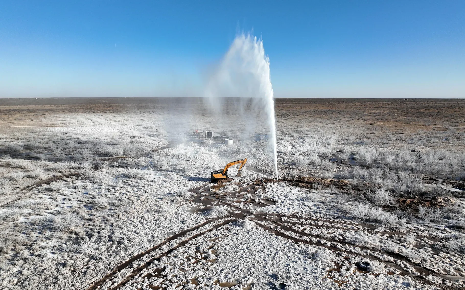
100ft tall saltwater geyser suddenly erupted from the ground. Thousands of barrels of saltwater per day. The leaking wellbore was plugged with great difficulty.
At the induced seismicity (human-made seismic activity) conference in Dallas a few weeks back, we learned how injecting large amounts of salt disposal water deep in the Permian Basin causes earthquakes over a wide area, many miles away from where the water was injected.
But seismicity is not the only effect that is noticeable as a result of injected water migrating under extreme pressure through various layers of earth, over large distances. For example, in the Tubbs Corner area in Crane County, a salt water geyser from an abandoned well. After being plugged, within 1 year and within 1 kilometer, saltwater started oozing out of a set of fissures. This second event is still leaking water to surface today.
The second surface event: water coming out of a fissure, a year after the geyser was plugged.
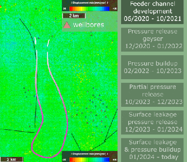
Starting in 2023 our Permian Basin team at SkyGeo has been conducting quarterly and iterative InSAR processing on behalf of a local rancher to specifically understand water migration in this active area – and its impact on their ranch.
We had the following six critical forensic findings:
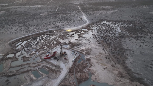
The surface expression of underground disposal water migration in a time lapse. Time periods are non-linear in this animation
The surface expression of underground disposal water migration in a time lapse. Time periods are non-linear in this animation
1. The two events are connected: caused by the same regional water pooling feature – which shows at the surface as a big (50 cm!) uplift dome of 3km across;
2. This source water originated more than 8 kilometers to the North, possibly from a cluster of injector wells – possibly further;
3. Six months before the geyser erupted, there was a first precursor in InSAR;
4. The well where the geyser occurred was shut in within weeks, after which the surface uplift resumed – uninterrupted for a year, until a second water-to-surface event happened;
5. The uplift is relaxing and seems to have reached a steady state today: as much water is leaking out as is being pushed in the sub-surface
6. We can still track the associated surface uplift anomaly in InSAR – the feeder channel has not relaxed so the original source is still feeding water.
In the images below, we can see the actual geyser and the historical progression demonstrating the wide area impact of water injection and how it led to this eruption.

InSAR time series over the uplift feature seen around the Tubbs Corner geyser, preceding the second surface event. Assessed from the ASC orbit.
Unfortunately, this isn’t an anomaly: we see similar patterns elsewhere. Clearly, InSAR can be an effective operational monitoring tool to help control and mitigate these types of local risk from the water injection, provided the essential work of optimizing the InSAR for the diagnostic signal has been done.

Illustration of surface dynamics interpretation of the SWD pressure build up and release